2007
SK4361 : Public footpath and fence
taken 16 years ago, near to Pilsley, Derbyshire, England
This is 1 of 2 images, with title Public footpath and fence in this square
Public footpath and fence
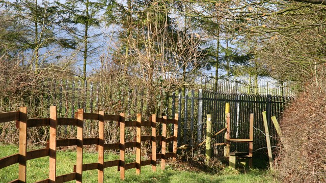
This north-westerly facing photograph is of a public footpath that connects SK4262 : Rouse Street, Pilsley (ahead) with SK4361 : Church Lane, Tibshelf (behind the viewpoint).
The stile is constructed from the rails of a narrow gauge mineral railway line and are a legacy of the areas mining past.
The footpath continues between the fencing and the field boundary on the right.
For a more north-westerly (ahead) photograph of the footpath, click here SK4361 : Public footpath and fence.
For a more south-easterly (behind the viewpoint) photograph of the footpath, click here SK4361 : Public footpath.
 Map © Crown Copyright")
TIP: Click the map for more Large scale mapping
- Grid Square
- SK4361, 71 images (more nearby 🔍)
- Photographer
- Alan Walker (more nearby)
- Date Taken
- Thursday, 29 November, 2007 (more nearby)
- Submitted
- Monday, 31 December, 2007
- Subject Location
-
OSGB36:
 SK 432 616 [100m precision]
WGS84: 53:9.0197N 1:21.2767W - Camera Location
-
OSGB36: SK 432 616
- View Direction
- Northwest (about 315 degrees)