2016
NY5865 : Piper Sike Turret (51a), Hadrian's Wall
taken 8 years ago, near to Low Row, Cumbria, England
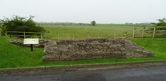
Piper Sike Turret (51a), Hadrian's Wall
Hadrian's wall or 'Vallum Aelium' is the remains of a large Roman fortification. The wall extended west from Segedunum at Wallsend on the River Tyne to the shore of the Solway Firth, ending a short but unknown distance west of the village of Bowness-on-Solway. Construction probably started sometime in AD 122 and was largely completed within six years.
The remains were made a UNESCO World Heritage Site in 1987.
See other images of Hadrian's Wall
The remains were made a UNESCO World Heritage Site in 1987.
See other images of Hadrian's Wall
 Map © Crown Copyright")
TIP: Click the map for more Large scale mapping
- Grid Square
- NY5865, 41 images (more nearby 🔍)
- Photographer
- habiloid (more nearby)
- Date Taken
- Tuesday, 2 August, 2016 (more nearby)
- Submitted
- Sunday, 19 April, 2020
- Subject Location
-
OSGB36:
 NY 5882 6530 [10m precision]
WGS84: 54:58.8354N 2:38.6977W - Camera Location
-
OSGB36: NY 5883 6529
- View Direction
- North-northwest (about 337 degrees)