2008
SK5741 : Cyprus Road, Mapperley Park
taken 16 years ago, near to Nottingham, England
This is 1 of 2 images, with title Cyprus Road, Mapperley Park in this square
Cyprus Road, Mapperley Park
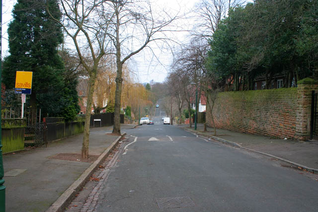
Looking north along Cyprus Road. The junction with Ebers Road can be seen on the left, and that with Merrivale Court on the right, just at the end of the high Bulwell stone wall. The boundary with SK5742 is about where the white vans are. Cyprus road continues up the hill to join Mapperley Hall Drive.
Typical of the streets in the Mapperley Park and Alexandra Park Conservation Area, Cyprus Road is lined with trees and has houses that exhibit a wide range of Vernacular Revival styles that defined the late Victorian and Edwardian periods.
Typical of the streets in the Mapperley Park and Alexandra Park Conservation Area, Cyprus Road is lined with trees and has houses that exhibit a wide range of Vernacular Revival styles that defined the late Victorian and Edwardian periods.
 Map © Crown Copyright")
TIP: Click the map for more Large scale mapping
- Grid Square
- SK5741, 278 images (more nearby 🔍)
- Photographer
- Kate Jewell (more nearby)
- Date Taken
- Thursday, 3 January, 2008 (more nearby)
- Submitted
- Thursday, 3 January, 2008
- Subject Location
-
OSGB36:
 SK 573 419 [100m precision]
WGS84: 52:58.3052N 1:8.8208W - Camera Location
-
OSGB36: SK 573 418
- View Direction
- North-northeast (about 22 degrees)