2008
SO9618 : The Cotswold Way on Hartley Hill
taken 16 years ago, near to Coberley, Gloucestershire, England
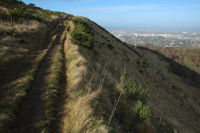
The Cotswold Way on Hartley Hill
The Cotswold Way is about 100 miles and links Chipping Campden in the north with the city of Bath in the south, for much of the way it follows the Cotswold escarpment. The path alternates between the bottom and top of the escarpment, here it is on top providing views over Cheltenham.
 Map © Crown Copyright")
TIP: Click the map for more Large scale mapping
- Grid Square
- SO9618, 50 images (more nearby 🔍)
- Photographer
- Philip Halling (more nearby)
- Date Taken
- Sunday, 6 January, 2008 (more nearby)
- Submitted
- Thursday, 10 January, 2008
- Subject Location
-
OSGB36:
 SO 961 183 [100m precision]
WGS84: 51:51.8392N 2:3.4389W - Camera Location
-
OSGB36: SO 962 183
- View Direction
- Northwest (about 315 degrees)