2017
NY7513 : Benchmark on Little Musgrave Farm
taken 7 years ago, near to Little Musgrave, Cumbria, England
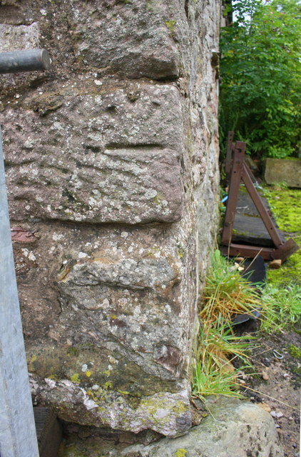
Benchmark on Little Musgrave Farm
Ordnance Survey cut mark benchmark described on the Bench Mark Database at Link
It seems likely that the stone has been moved because the benchmark is inverted and its location does not match that verified by the Ordnance Survey in 1955.
It seems likely that the stone has been moved because the benchmark is inverted and its location does not match that verified by the Ordnance Survey in 1955.
 Map © Crown Copyright")
TIP: Click the map for more Large scale mapping
- Grid Square
- NY7513, 5 images (more nearby 🔍)
- Photographer
- Roger Templeman (more nearby)
- Date Taken
- Tuesday, 5 September, 2017 (more nearby)
- Submitted
- Monday, 27 July, 2020
- Subject Location
-
OSGB36:
 NY 7591 1315 [10m precision]
WGS84: 54:30.7845N 2:22.4160W - Camera Location
-
OSGB36: NY 7591 1315
- View Direction
- West-southwest (about 247 degrees)