2008
SO5883 : Close up of waymarker on Jack Mytton Way
taken 16 years ago, near to Stoke st Milborough, Shropshire, England
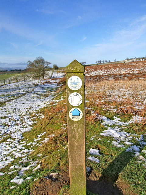
Close up of waymarker on Jack Mytton Way
This is a closer view of the waymarker on the Jack Mytton Way at the point where a public footpath comes in from the right which provides a link to The Shropshire Way.
 Map © Crown Copyright")
TIP: Click the map for more Large scale mapping
- Grid Square
- SO5883, 17 images (more nearby 🔍)
- Photographer
- P L Chadwick (more nearby)
- Date Taken
- Saturday, 12 January, 2008 (more nearby)
- Submitted
- Saturday, 12 January, 2008
- Subject Location
-
OSGB36:
 SO 585 830 [100m precision]
WGS84: 52:26.6139N 2:36.6568W - Camera Location
-
OSGB36: SO 586 829
- View Direction
- Northwest (about 315 degrees)