2008
NH8120 : Glen under Carn Coire na Caorach
taken 16 years ago, 4 km W of Dalnahaitnach, Highland, Scotland
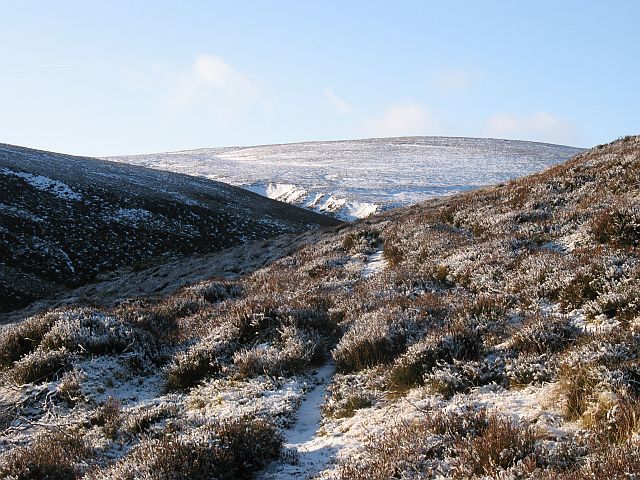
Glen under Carn Coire na Caorach
The burn in this glen changes name almost every confluence but becomes the Leth-allt. The snow covered landslip scars in the middle of the picture are above the Caochan na Cuileage where it meets the Allt an t-Sionnaich.
The snow covered heather is typical of the area, a managed grouse moor.
The snow covered heather is typical of the area, a managed grouse moor.
 Map © Crown Copyright")
TIP: Click the map for more Large scale mapping
- Grid Square
- NH8120, 5 images (more nearby 🔍)
- Photographer
- Richard Webb (more nearby)
- Date Taken
- Saturday, 19 January, 2008 (more nearby)
- Submitted
- Sunday, 20 January, 2008
- Subject Location
-
OSGB36:
 NH 813 206 [100m precision]
WGS84: 57:15.6482N 3:58.1107W - Camera Location
-
OSGB36: NH 819 209
- View Direction
- West-southwest (about 247 degrees)