2008
SE2239 : Layton Road and Brownberrie Lane, Horsforth
taken 16 years ago, near to Horsforth, Leeds, England
This is 1 of 5 images, with title starting with Layton Road in this square
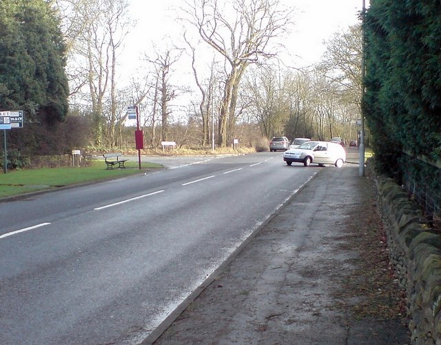
Layton Road and Brownberrie Lane, Horsforth
Looking east along Layton Road to the junction with Bayton Lane (left), Brownberrie Lane (ahead), and West End Lane (right). For a view from the bus stop see [[[663108]]
 Map © Crown Copyright")
TIP: Click the map for more Large scale mapping
- Grid Square
- SE2239, 77 images (more nearby 🔍)
- Photographer
- Rich Tea (more nearby)
- Date Taken
- Saturday, 19 January, 2008 (more nearby)
- Submitted
- Wednesday, 23 January, 2008
- Subject Location
-
OSGB36:
 SE 228 393 [100m precision]
WGS84: 53:50.9717N 1:39.2401W - Camera Location
-
OSGB36: SE 228 392
- View Direction
- East-northeast (about 67 degrees)