2008
SS5723 : Field near Wanhill
taken 16 years ago, near to Langridgeford, Devon, England
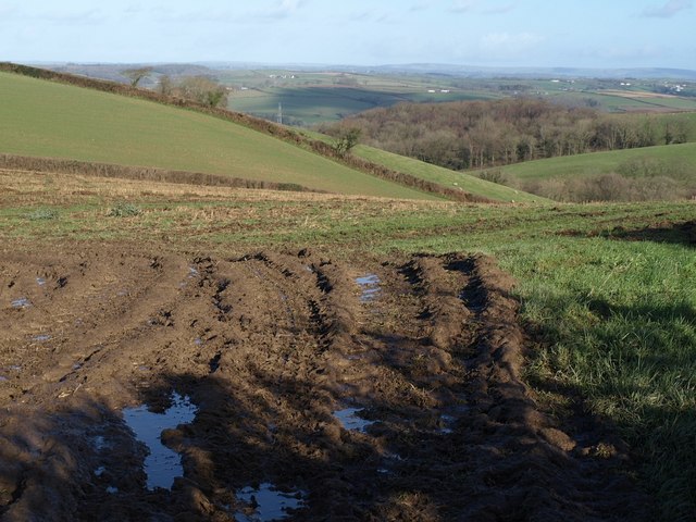
Field near Wanhill
Looking in the opposite direction from SS5723 : Langham Lake valley, towards the east side of the ridge that SS5723 : Lane to Brown's Hill Head runs along. The intermittent trees along the field boundary can be spotted in SS5723 : Farmland at Wanhill.
 Map © Crown Copyright")
TIP: Click the map for more Large scale mapping
- Grid Square
- SS5723, 34 images (more nearby 🔍)
- Photographer
- Derek Harper (more nearby)
- Date Taken
- Thursday, 24 January, 2008 (more nearby)
- Submitted
- Wednesday, 30 January, 2008
- Subject Location
-
OSGB36:
 SS 5754 2372 [10m precision]
WGS84: 50:59.7116N 4:1.8850W - Camera Location
-
OSGB36: SS 5751 2368
- View Direction
- Northeast (about 45 degrees)