2008
TR2953 : Black Lane from Thornton Road
taken 16 years ago, near to Knowlton, Kent, England
Black Lane from Thornton Road
Link
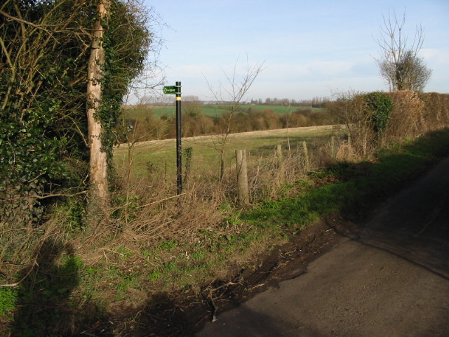
Black Lane is an old road, once part of a through route between Canterbury and Deal. It is a continuation of Knowlton Lane east, across the old Link Thornton Lane, Pike Road and (now) the Dover Road (Whitfield Bypass), terminating on Straight Mile at the junction with Cater Road. Most of the road is now unrecorded, but part, about 1km west of Thornton Lane, is now recorded as a public footpath as far as the parish boundary of Eastry and Knowlton but is impassable as it sees little use having no recorded continuation west into Knowlton. The line of the road is still well defined west of Pike Road, and forms a distinct hollow way between Thornton Lane and the Knowlton parish boundary.
Black Lane is an old road, once part of a through route between Canterbury and Deal. It is a continuation of Knowlton Lane east, across the old Link Thornton Lane, Pike Road and (now) the Dover Road (Whitfield Bypass), terminating on Straight Mile at the junction with Cater Road. Most of the road is now unrecorded, but part, about 1km west of Thornton Lane, is now recorded as a public footpath as far as the parish boundary of Eastry and Knowlton but is impassable as it sees little use having no recorded continuation west into Knowlton. The line of the road is still well defined west of Pike Road, and forms a distinct hollow way between Thornton Lane and the Knowlton parish boundary.
 Map © Crown Copyright")
TIP: Click the map for more Large scale mapping
- Grid Square
- TR2953, 27 images (more nearby 🔍)
- Photographer
- Nick Smith (more nearby)
- Date Taken
- Sunday, 27 January, 2008 (more nearby)
- Submitted
- Friday, 1 February, 2008
- Subject Location
-
OSGB36:
 TR 293 532 [100m precision]
WGS84: 51:13.9287N 1:17.0216E - Camera Location
-
OSGB36: TR 293 531
- View Direction
- NORTH (about 0 degrees)