2016
SD2780 : Stile on The Cumbria Way
taken 8 years ago, near to Mansriggs, Cumbria, England
This is 1 of 2 images, with title Stile on The Cumbria Way in this square
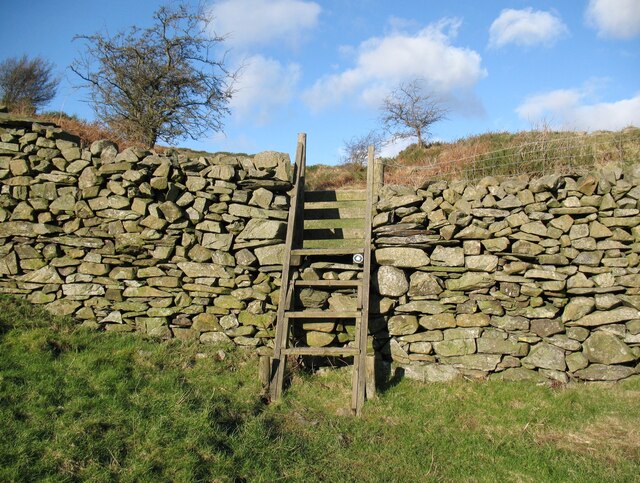
Stile on The Cumbria Way
This stile is on the public footpath from Bortree Stile to Higher Lath Farm which is also the route of The Cumbria Way long distance footpath (next photograph SD2780 : The Cumbria Way near Bortree Stile).
The dry stone wall is built from Silurian slate.
The dry stone wall is built from Silurian slate.
The Cumbria Way
A 119km (74 mile) long distance path from Ulverston to Carlisle, through the heart of the English Lake District.
 Map © Crown Copyright")
TIP: Click the map for more Large scale mapping
- Grid Square
- SD2780, 40 images (more nearby 🔍)
- Photographer
- Adrian Taylor (more nearby)
- Date Taken
- Wednesday, 10 February, 2016 (more nearby)
- Submitted
- Sunday, 28 March, 2021
- Subject Location
-
OSGB36:
 SD 27716 80018 [1m precision]
WGS84: 54:12.6468N 3:6.5900W - Camera Location
-
OSGB36: SD 27722 79982
- View Direction
- NORTH (about 0 degrees)