2008
SX5575 : Merrivale Bridge
taken 16 years ago, near to Merrivale, Devon, England
This is 1 of 2 images, with title Merrivale Bridge in this square
Merrivale Bridge
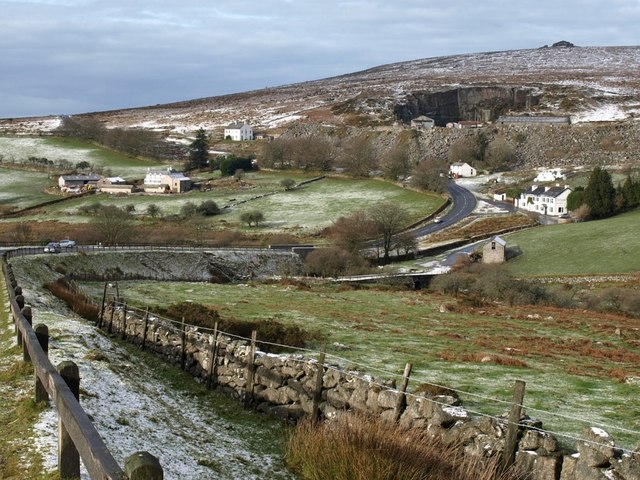
The old, nearer, bridge, and the barn, which also appear in SX5575 : Merrivale Bridge, are in SX5575, but the other buildings (SX5475 : Dartmoor Inn, Merrivale on the right, Merrivale Farm left centre, and the quarry to the right, are all in SX5475. The B3357 now crosses the River Walkham by a newer bridge (also in SX5475). On the horizon is Middle Staple Tor.
 Map © Crown Copyright")
TIP: Click the map for more Large scale mapping
- Grid Square
- SX5575, 36 images (more nearby 🔍)
- Photographer
- Derek Harper (more nearby)
- Date Taken
- Saturday, 2 February, 2008 (more nearby)
- Submitted
- Thursday, 7 February, 2008
- Subject Location
-
OSGB36:
 SX 5502 7510 [10m precision]
WGS84: 50:33.4576N 4:2.8871W - Camera Location
-
OSGB36: SX 5523 7502
- View Direction
- West-northwest (about 292 degrees)