2008
SE3481 : Former village inn, Sinderby
taken 16 years ago, near to Sinderby, North Yorkshire, England
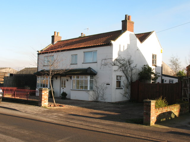
Former village inn, Sinderby
Until 1995 this was the Brewers Arms pub, but like many pubs in rural locations it struggled to survive despite a 'community pub' award. After closing its doors for the last time it was converted into a house.
 Map © Crown Copyright")
TIP: Click the map for more Large scale mapping
- Grid Square
- SE3481, 21 images (more nearby 🔍)
- Photographer
- Gordon Hatton (more nearby)
- Date Taken
- Wednesday, 13 February, 2008 (more nearby)
- Submitted
- Wednesday, 13 February, 2008
- Subject Location
-
OSGB36:
 SE 345 819 [100m precision]
WGS84: 54:13.9100N 1:28.3349W - Camera Location
-
OSGB36: SE 344 819
- View Direction
- East-northeast (about 67 degrees)