2021
SH7112 : Slopes of Cadair Idris
taken 3 years ago, 3 km from Minffordd, Gwynedd, Wales
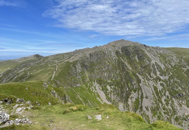
Slopes of Cadair Idris
Looking northwards from Craig Cwm Amarch at the scree slopes of Cadair Idris with the summit at Penygadair at a height of 893 metres. Cadair Idris translates to Chair of Idris in English.
 Map © Crown Copyright")
TIP: Click the map for more Large scale mapping
- Grid Square
- SH7112, 141 images (more nearby 🔍)
- Photographer
- Chris Thomas-Atkin (more nearby)
- Date Taken
- Tuesday, 15 June, 2021 (more nearby)
- Submitted
- Tuesday, 29 June, 2021
- Subject Location
-
OSGB36:
 SH 7107 1279 [10m precision]
WGS84: 52:41.8435N 3:54.5595W - Camera Location
-
OSGB36: SH 71065 12132
- View Direction
- NORTH (about 0 degrees)