2008
SX9192 : Stream bed, former leat, Exeter quay with road bridge
taken 16 years ago, near to Exeter, Devon, England
This is 1 of 2 images, with title starting with Stream bed, former leat, Exeter in this square
Stream bed, former leat, Exeter quay with road bridge
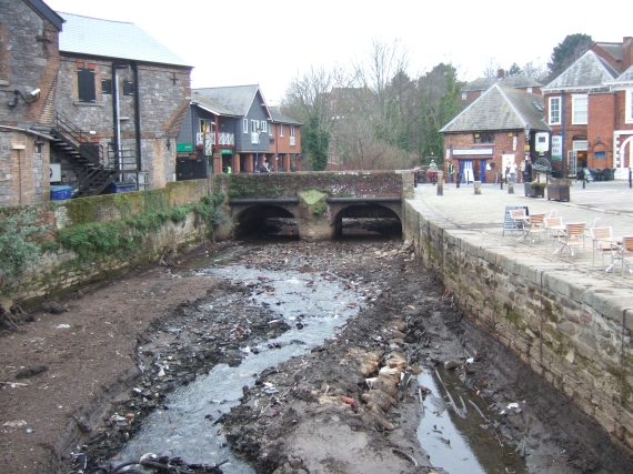
In February 2008, the Environment Agency carried out survey and dredging work on the River Exe between Millers Bridge (SX914926) and Trews Weir (SX924915) which meant that the river level was lowered by between 1 and 2 metres. This is one of a set of pictures showing the river in such unusual circumstances. The pictures of the quay form a panorama showing some of the bedrock on which the quay was built.
Here is the stream bed of one leat with reduced flow
Here is the stream bed of one leat with reduced flow
 Map © Crown Copyright")
TIP: Click the map for more Large scale mapping
- Grid Square
- SX9192, 1542 images (more nearby 🔍)
- Photographer
- David Smith (more nearby)
- Date Taken
- Friday, 15 February, 2008 (more nearby)
- Submitted
- Friday, 15 February, 2008
- Subject Location
-
OSGB36:
 SX 919 921 [100m precision]
WGS84: 50:43.1069N 3:31.9256W - Camera Location
-
OSGB36: SX 919 920
- View Direction
- North-northwest (about 337 degrees)