2008
NX9774 : Kirkpatrick Macmillan Footbridge
taken 16 years ago, near to Kingholm Quay, Dumfries And Galloway, Scotland
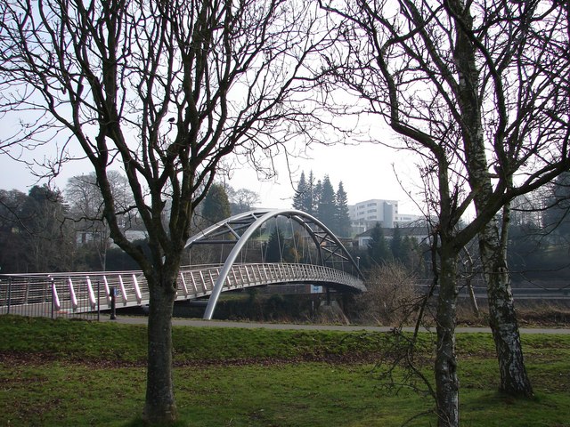
Kirkpatrick Macmillan Footbridge
Kirkpatrick Macmillan Footbridge (2006): Southernmost Nith bridge connects Troqueer with Castledykes Park, Crichton complex and the Dumfries & Galloway Royal Infirmary. Some buildings of the Infirmary can be seen in the background.
 Map © Crown Copyright")
TIP: Click the map for more Large scale mapping
- Grid Square
- NX9774, 59 images (more nearby 🔍)
- Photographer
- Chris Newman (more nearby)
- Date Taken
- Sunday, 17 February, 2008 (more nearby)
- Submitted
- Sunday, 17 February, 2008
- Subject Location
-
OSGB36:
 NX 9792 7481 [10m precision]
WGS84: 55:3.4349N 3:35.9772W - Camera Location
-
OSGB36: NX 9759 7488
- View Direction
- East-southeast (about 112 degrees)