2005
SU2213 : Green Pond, Fritham Plain, New Forest
taken 18 years ago, near to Fritham, Hampshire, England
This is 1 of 2 images, with title Green Pond, Fritham Plain, New Forest in this square
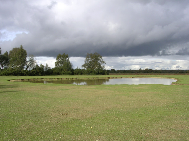
Green Pond, Fritham Plain, New Forest
Green Pond is in the middle of Fritham Plain, a heathland plateau to the southwest of Fritham village. The pond is a watering hole for the Commoners' stock on this otherwise high and dry hill, and since it doesn't feature on the 1940s maps I assume it was dug out specifically for this purpose (like Longcross and Ocknell ponds).
 Map © Crown Copyright")
TIP: Click the map for more Large scale mapping
- Grid Square
- SU2213, 37 images (more nearby 🔍)
- Photographer
- Jim Champion (more nearby)
- Date Taken
- Sunday, 23 October, 2005 (more nearby)
- Submitted
- Sunday, 23 October, 2005
- Subject Location
-
OSGB36:
 SU 226 135 [100m precision]
WGS84: 50:55.2312N 1:40.7912W