2008
NX7145 : Dunrod Mill
taken 16 years ago, near to Townhead, Dumfries And Galloway, Scotland
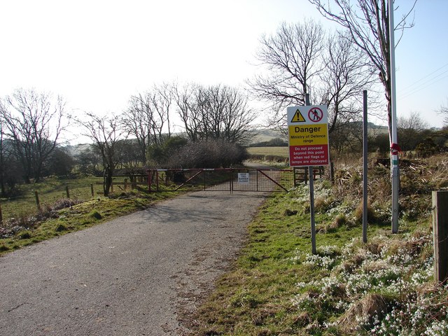
Dunrod Mill
This section of the lane between Townhead and Ringliggate Junction (A711) runs through the MOD Kirkcudbright Training Range and is subject to closure. A large area is permanently closed to the public, including this lane that leads off the Townhead lane close to the former Dunrod Mill (Balig Hill).
 Map © Crown Copyright")
TIP: Click the map for more Large scale mapping
- Grid Square
- NX7145, 4 images (more nearby 🔍)
- Photographer
- Chris Newman (more nearby)
- Date Taken
- Monday, 18 February, 2008 (more nearby)
- Submitted
- Monday, 18 February, 2008
- Subject Location
-
OSGB36:
 NX 7102 4591 [10m precision]
WGS84: 54:47.4868N 4:0.4509W - Camera Location
-
OSGB36: NX 7101 4594
- View Direction
- South-southeast (about 157 degrees)