2008
TQ0152 : River Wey Navigation near Bowers Lock
taken 16 years ago, near to Burpham, Surrey, England
This is 1 of 2 images, with title River Wey Navigation near Bowers Lock in this square
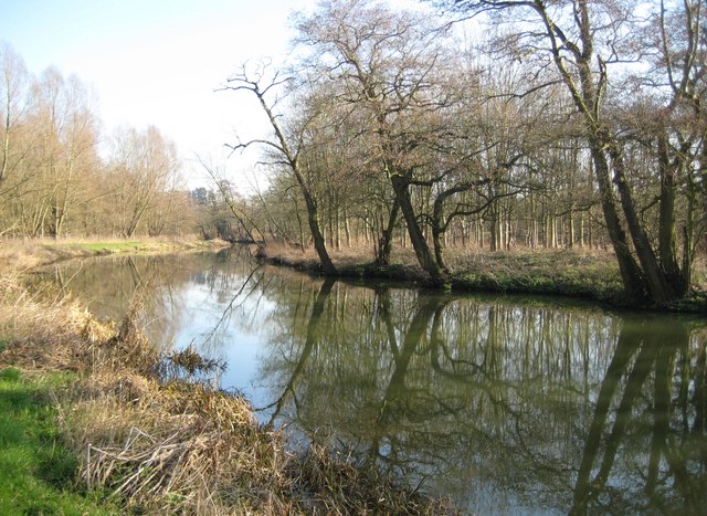
River Wey Navigation near Bowers Lock
The towpath on the left forms part of the E2 European Long Distance Footpath which runs from Galway to France's Mediterranean coast. Beyond the towpath and further to the left are the woods of the Sutton Place estate. The apparent rural tranquillity is alas not present because of the continuous noise of the traffic from the A3 road which is just beyond the trees to the right.
 Map © Crown Copyright")
TIP: Click the map for more Large scale mapping
- Grid Square
- TQ0152, 156 images (more nearby 🔍)
- Photographer
- Nigel Cox (more nearby)
- Date Taken
- Sunday, 17 February, 2008 (more nearby)
- Submitted
- Tuesday, 19 February, 2008
- Subject Location
-
OSGB36:
 TQ 016 528 [100m precision]
WGS84: 51:15.9187N 0:32.7091W - Camera Location
-
OSGB36: TQ 015 528
- View Direction
- EAST (about 90 degrees)