Geograph - photograph every grid square
2006
NX1076
: Altimeg Hill
taken
18 years ago
, 4 km S of
Smyrton
, South Ayrshire, Scotland
This is 1 of
4 images, with title Altimeg Hill
in this square
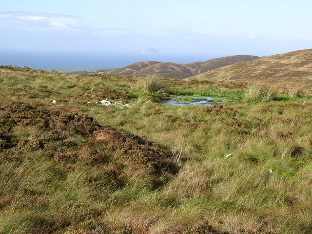
Altimeg Hill
Boggy ground on wide Summit, in the far distance you can see Ailsa Craig
© Copyright
Billy McCrorie
and licensed for
reuse
under this
Creative Commons Licence
.
Licensing
Download
Share...
Share this photo via Twitter
Share this photo via Facebook
Share this photo via Pinterest
Share this photo via Flipboard
Share this photo via email/e-card
Grab a Stamped/Watermarked Image
Mark
👍🏻
Like Image
👍🏻
Like Description
Update Information
Contact Contributor
Category:
Hill
This photo is linked from:
Automatic Clusters
: ·
Altimeg Hill [4]
·
Summit [2]
Title Clusters
: ·
Altimeg Hill [4]
·
TIP: Click the map for more Large scale mapping
Grid Square
NX1076
, 5 images (
more nearby
🔍
)
Photographer
Billy McCrorie
(
more nearby
)
Date Taken
Monday, 9 October, 2006 (
more nearby
)
Submitted
Thursday, 21 February, 2008
Subject Location
OSGB36:
NX 106 763
[100m precision]
WGS84:
55:2.7016N
4:57.9068W
Camera Location
OSGB36:
NX 108 762
View Direction
West-northwest (about 292 degrees)
NW
N
NE
W
Go
E
SW
S
SE
Discuss NX1076
View this location on ...
Geograph Coverage Map (includes OSM etc)
Geograph Links Page
Open in Google Maps
Navigate to location with Google Maps
Open in Google Earth Pro
Open in Google Earth for Web
Open in Bing Maps
Navigate with Google Maps
Lookup nearest Postcode
Image classification
(about)
: Geograph (First for NX1076) · First in 5 Years (TPoint)
(about)
This page has been
viewed
about
30
times
☰
Home
View
Search
Marked Images
Maps
Browser
Explore
Showcase
New Images
Collections
Interact
Games
Discussions
Blog
Contributors
Submit
Statistics
Leaderboards
General
FAQ
Help Pages
Sitemap
Contact Us
Support Us
sponsored by
🔍
What to search:
Photos
Enter keywords or a location/postcode to search nearby images
Photos near NX1076
Enter a Grid Reference
Placenames
Collections
Website Pages
Everything
Others:
Advanced Search
|
Image Browser
Or:
Coverage Map
|
Searchable Map
You are not logged in
login
|
register