2008
SX2284 : Hedge and trees near Laneast
taken 16 years ago, near to Laneast, Cornwall, England
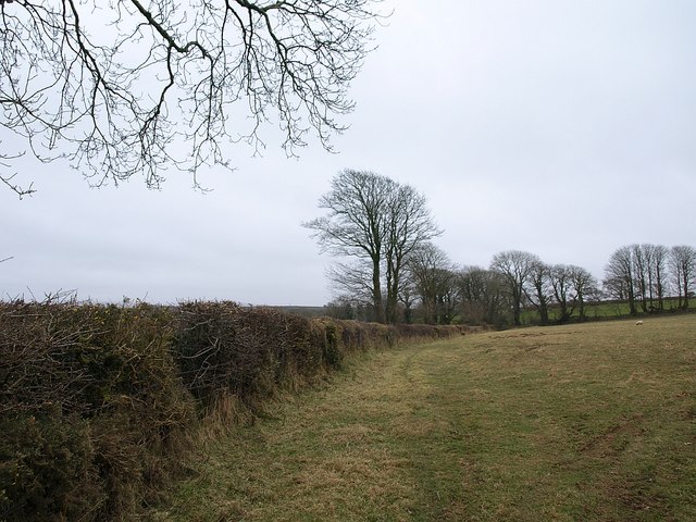
Hedge and trees near Laneast
Few field boundaries in this area are straight for very long, and this one shows the characteristic gentle curve across slopes near the Inny valley. The mature trees, with relatively little sign of wind shaping, indicate this is fairly sheltered spot.
 Map © Crown Copyright")
TIP: Click the map for more Large scale mapping
- Grid Square
- SX2284, 12 images (more nearby 🔍)
- Photographer
- Derek Harper (more nearby)
- Date Taken
- Thursday, 21 February, 2008 (more nearby)
- Submitted
- Friday, 22 February, 2008
- Subject Location
-
OSGB36:
 SX 2266 8420 [10m precision]
WGS84: 50:37.8274N 4:30.5330W - Camera Location
-
OSGB36: SX 2270 8428
- View Direction
- South-southwest (about 202 degrees)