2005
SO6732 : Road junction near Much Marcle
taken 18 years ago, near to Much Marcle, County of Herefordshire, England
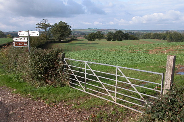
Road junction near Much Marcle
The church tower at Much Marcle is visible in the middle distance. The Ridge Hill transmitter can be seen on the horizon.
 Map © Crown Copyright")
TIP: Click the map for more Large scale mapping
- Grid Square
- SO6732, 25 images (more nearby 🔍)
- Photographer
- Philip Halling (more nearby)
- Date Taken
- Saturday, 22 October, 2005 (more nearby)
- Submitted
- Tuesday, 25 October, 2005
- Subject Location
-
OSGB36:
 SO 676 321 [100m precision]
WGS84: 51:59.2275N 2:28.3581W - Camera Location
-
OSGB36: SO 677 321
- View Direction
- West-northwest (about 292 degrees)