2008
SH3645 : The upper part of Gwaith Mawr (Eifl Granite Quarry) seen from the slopes of the central peak of Yr Eifl
taken 16 years ago, near to Trefor, Gwynedd, Wales
This is 1 of 4 images, with title starting with The upper in this square
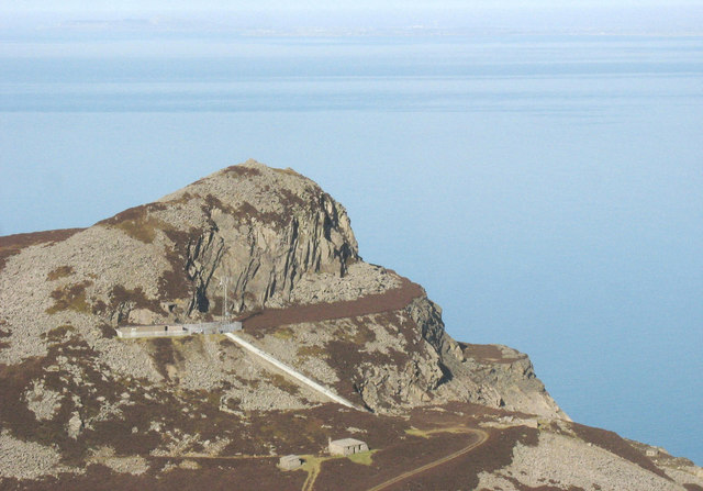
The upper part of Gwaith Mawr (Eifl Granite Quarry) seen from the slopes of the central peak of Yr Eifl
This photo shows the summit cairn and bouldery western slopes of Mynydd y Gwaith, the Llithfaen North Telecommunications station which is located at the southern end of the upper terrace of the Eifl Quarry, and the stairway and track linking the station to the Bwlch yr Eifl track.
 Map © Crown Copyright")
TIP: Click the map for more Large scale mapping
- Grid Square
- SH3645, 114 images (more nearby 🔍)
- Photographer
- Eric Jones (more nearby)
- Date Taken
- Wednesday, 13 February, 2008 (more nearby)
- Submitted
- Saturday, 23 February, 2008
- Subject Location
-
OSGB36:
 SH 361 457 [100m precision]
WGS84: 52:59.0172N 4:26.5025W - Camera Location
-
OSGB36: SH 364 451
- View Direction
- North-northwest (about 337 degrees)