2008
SX5546 : Netton Down
taken 16 years ago, near to Noss Mayo, Devon, England
This is 1 of 6 images, with title Netton Down in this square
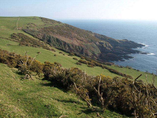
Netton Down
A sloping hillside of grass and patches of gorse. Taken from the South West Coast Path as it descends gently towards Stoke Down in the background. The headland is Stoke Point in SX5545 - compare SX5545 : Stoke Point, taken from further southwest.
 Map © Crown Copyright")
TIP: Click the map for more Large scale mapping
- Grid Square
- SX5546, 51 images (more nearby 🔍)
- Photographer
- Derek Harper (more nearby)
- Date Taken
- Sunday, 17 February, 2008 (more nearby)
- Submitted
- Sunday, 24 February, 2008
- Subject Location
-
OSGB36:
 SX 557 460 [100m precision]
WGS84: 50:17.7756N 4:1.6393W - Camera Location
-
OSGB36: SX 5567 4611
- View Direction
- Southeast (about 135 degrees)