2008
SU1332 : Old Sarum's outer ditch
taken 16 years ago, near to Ford, Wiltshire, England
This is 1 of 3 images, with title Old Sarum's outer ditch in this square
Old Sarum's outer ditch
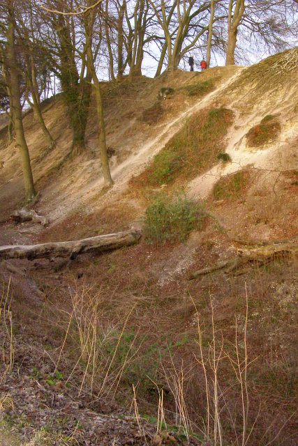
The steep bank on the western side of Old Sarum, viewed from the top of the outer counter-scarp bank (with the ditch below). The people standing at the top of the inner bank give an impression of the scale of this vast earthwork. Although the defences were first built in the Iron Age they were expanded by the Saxons and Normans. It looks like this part of the bank has been used as a 'slide' in the recent past.
 Map © Crown Copyright")
TIP: Click the map for more Large scale mapping
- Grid Square
- SU1332, 329 images (more nearby 🔍)
- Photographer
- Jim Champion (more nearby)
- Date Taken
- Wednesday, 20 February, 2008 (more nearby)
- Submitted
- Monday, 25 February, 2008
- Subject Location
-
OSGB36:
 SU 1354 3268 [10m precision]
WGS84: 51:5.5963N 1:48.4820W - Camera Location
-
OSGB36: SU 1353 3266
- View Direction
- North-northeast (about 22 degrees)