2008
SU2790 : Pastures, Longcot
taken 16 years ago, near to Longcot, Oxfordshire, England
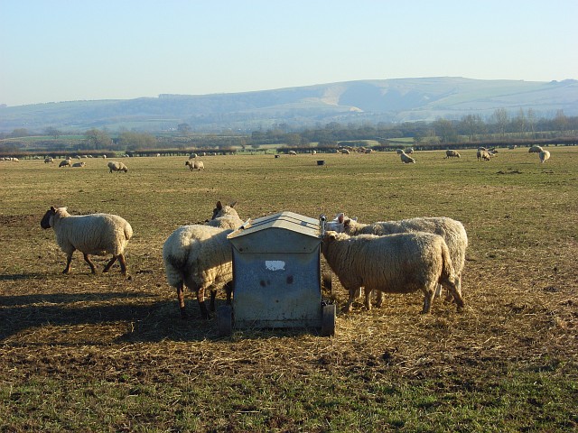
Pastures, Longcot
A typical scene in the Vale of Whitehorse where there seems to be a fairly even split between arable and pastoral farming. In the background is Whitehorse Hill above Uffington. The chalk figure, after which the hill and valley are named, was discernible to the human eye from this vantage point but can't be made out in the photo. The Manger is the shadowy combe on the flank of the hill.
 Map © Crown Copyright")
TIP: Click the map for more Large scale mapping
- Grid Square
- SU2790, 80 images (more nearby 🔍)
- Photographer
- Andrew Smith (more nearby)
- Date Taken
- Sunday, 17 February, 2008 (more nearby)
- Submitted
- Monday, 25 February, 2008
- Subject Location
-
OSGB36:
 SU 275 903 [100m precision]
WGS84: 51:36.6519N 1:36.2557W - Camera Location
-
OSGB36: SU 274 905
- View Direction
- South-southeast (about 157 degrees)