2008
SE1422 : Weir at Sugden's Mill, Brighouse
taken 16 years ago, near to Brighouse, Calderdale, England
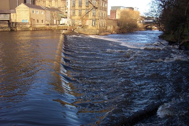
Weir at Sugden's Mill, Brighouse
The weir controlled the water level in the River Calder to provide power to the water wheel of the old flour mill. The intake to the mill race lies at the far end of the weir from the camera
 Map © Crown Copyright")
TIP: Click the map for more Large scale mapping
- Grid Square
- SE1422, 1144 images (more nearby 🔍)
- Photographer
- Richard Kay (more nearby)
- Date Taken
- Tuesday, 26 February, 2008 (more nearby)
- Submitted
- Tuesday, 26 February, 2008
- Subject Location
-
OSGB36:
 SE 145 225 [100m precision]
WGS84: 53:41.9675N 1:46.8841W - Camera Location
-
OSGB36: SE 144 225
- View Direction
- East-northeast (about 67 degrees)