2005
NG9153 : Sgurr Dubh from the Loch an Eion path
taken 19 years ago, near to Annat, Highland, Scotland
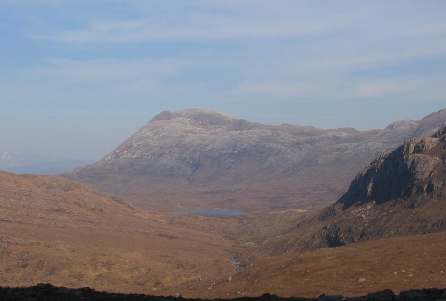
Sgurr Dubh from the Loch an Eion path.
A view eastwards up Srath nam Poll Dubh from the pony track up to Loch an Eion from Torridon. The peak is Sgurr Dubh (782m)
 Map © Crown Copyright")
TIP: Click the map for more Large scale mapping
- Grid Square
- NG9153, 14 images (more nearby 🔍)
- Photographer
- Richard Webb (more nearby)
- Date Taken
- Wednesday, 20 April, 2005 (more nearby)
- Submitted
- Wednesday, 4 May, 2005
- Subject Location
-
OSGB36:
 NG 91 53 [1000m precision]
WGS84: 57:31.4091N 5:29.0223W