2007
SD8077 : View from the track to Old Ing
taken 17 years ago, near to High Birkwith, North Yorkshire, England
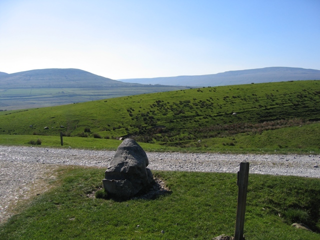
View from the track to Old Ing
The track in front of the camera is between High Birkwith to the left and Old Ing to the right. The Ribble Way turns left at this point. Simon Fell is in the distance on the left and Whernside on the right.
 Map © Crown Copyright")
TIP: Click the map for more Large scale mapping
- Grid Square
- SD8077, 73 images (more nearby 🔍)
- Photographer
- John S Turner (more nearby)
- Date Taken
- Wednesday, 2 May, 2007 (more nearby)
- Submitted
- Friday, 29 February, 2008
- Subject Location
-
OSGB36:
 SD 8032 7717 [10m precision]
WGS84: 54:11.3949N 2:18.1857W - Camera Location
-
OSGB36: SD 8034 7716
- View Direction
- West-northwest (about 292 degrees)