2005
NS4537 : New flood defences at Hurlford
taken 18 years ago, near to Hurlford, East Ayrshire, Scotland
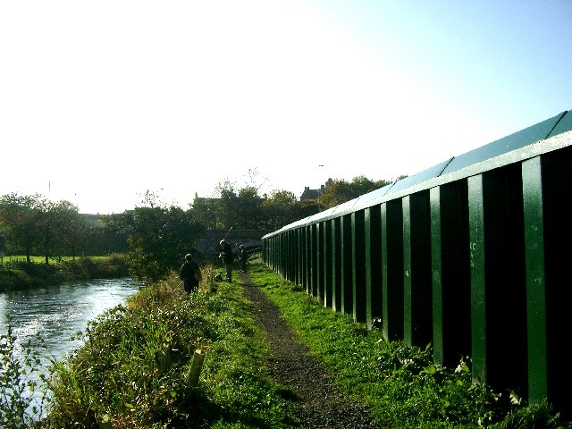
New flood defences at Hurlford
After extensive flooding in downstream Kilmarnock, these (and other) flood defences have been erected in 2004/2005 to control the river Irvine, here seen approaching the main road bridge at Hurleford, Ayrshire. Private houses and gardens are just over the other side of this new barrier. The new works don't seem to be interfering with these fishermen
 Map © Crown Copyright")
TIP: Click the map for more Large scale mapping
- Grid Square
- NS4537, 21 images (more nearby 🔍)
- Photographer
- Gordon Brown (more nearby)
- Date Taken
- Thursday, 27 October, 2005 (more nearby)
- Submitted
- Thursday, 27 October, 2005
- Subject Location
-
OSGB36:
 NS 4549 3702 [10m precision]
WGS84: 55:36.1318N 4:27.2417W - Camera Location
-
OSGB36: NS 4549 3705
- View Direction
- South-southwest (about 202 degrees)