1990
TQ3161 : Brighton Road, Purley - 1990
taken 34 years ago, near to Purley, Croydon, England
This is 1 of 8 images, with title Brighton Road, Purley - 1990 in this square
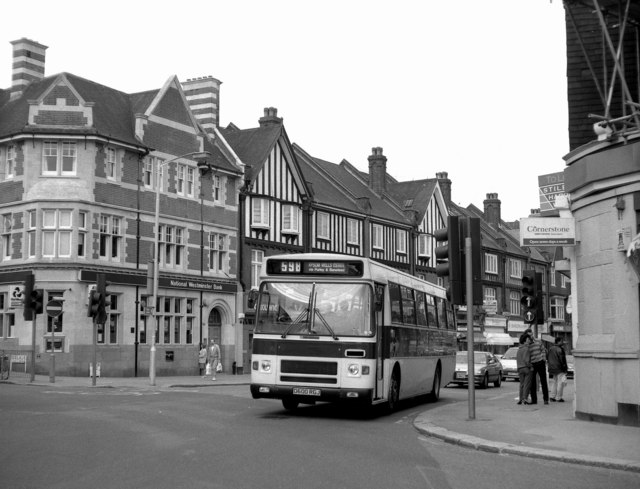
Brighton Road, Purley - 1990
This shows one of the dual-purpose saloons used by Banstead Buses on their long 598 route from West Croydon to Epsom. This route was subsidised by Surrey County Council, but the drivers accepted London Transport passes.
 Map © Crown Copyright")
TIP: Click the map for more Large scale mapping
- Grid Square
- TQ3161, 201 images (more nearby 🔍)
- Photographer
- Dr Neil Clifton (more nearby)
- Date Taken
- Saturday, 22 September, 1990 (more nearby)
- Submitted
- Saturday, 1 March, 2008
- Subject Location
-
OSGB36:
 TQ 312 616 [100m precision]
WGS84: 51:20.3168N 0:7.0205W - Camera Location
-
OSGB36: TQ 312 615
- View Direction
- Northeast (about 45 degrees)