2008
TQ3118 : Martlets Heights
taken 16 years ago, near to Burgess Hill, West Sussex, England
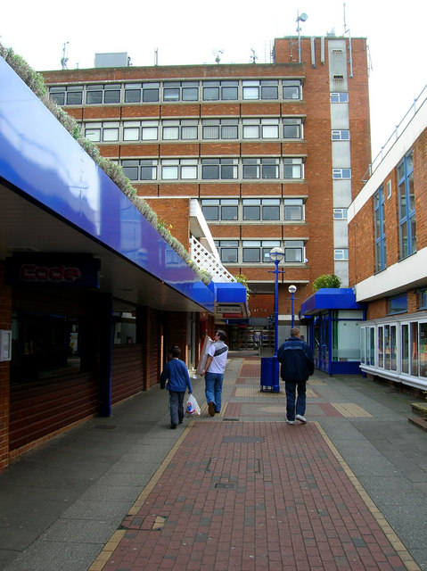
Martlets Heights
Set of offices originally built as part of The Martlets shopping centre in 1972. Where once the route led to an open air market it now leads onto an entrance to Market Place, a newer covered shopping centre built in 1991. However, on Sundays this entrance is blocked necessitating a detour around the rear.
 Map © Crown Copyright")
TIP: Click the map for more Large scale mapping
- Grid Square
- TQ3118, 85 images (more nearby 🔍)
- Photographer
- Simon Carey (more nearby)
- Date Taken
- Sunday, 2 March, 2008 (more nearby)
- Submitted
- Sunday, 2 March, 2008
- Subject Location
-
OSGB36:
 TQ 313 189 [100m precision]
WGS84: 50:57.3127N 0:7.9187W - Camera Location
-
OSGB36: TQ 312 189
- View Direction
- Southeast (about 135 degrees)