2003
SX9879 : Dawlish Warren Sand Dunes
taken 21 years ago, near to Dawlish Warren, Devon, England
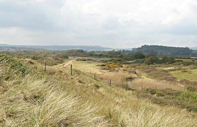
Dawlish Warren Sand Dunes
The photograph was taken looking west along the spit. The foredunes, closest to the sea are on the left side of the photograph covered mainly with Marram Grass. The dune slack area in the centre has short grassland and some scrub and is pocketed with lagoons where the land dips below the local water table. To the right is the older dune line where scrubland vegetation predominates.
 Map © Crown Copyright")
TIP: Click the map for more Large scale mapping
- Grid Square
- SX9879, 76 images (more nearby 🔍)
- Photographer
- Tony Atkin (more nearby)
- Date Taken
- Monday, 21 April, 2003 (more nearby)
- Submitted
- Friday, 28 October, 2005
- Subject Location
-
OSGB36:
 SX 988 793 [100m precision]
WGS84: 50:36.2769N 3:25.8868W - Camera Location
-
OSGB36: SX 984 791