2005
NF7217 : Causeway to An Leth Meadhanach
taken 19 years ago, near to North Boisdale, South Uist & Benbecula, Na h-Eileanan an Iar, Scotland
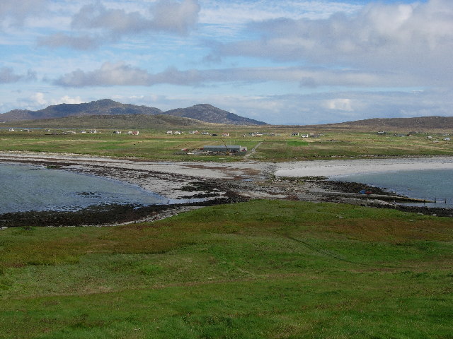
Causeway to An Leth Meadhanach
Trying to form a tombolo but covered at high tide.
 Map © Crown Copyright")
TIP: Click the map for more Large scale mapping
- Grid Square
- NF7217, 11 images (more nearby 🔍)
- Photographer
- Hugh Venables (more nearby)
- Date Taken
- Thursday, 15 September, 2005 (more nearby)
- Submitted
- Saturday, 29 October, 2005
- Subject Location
-
OSGB36:
 NF 729 173 [100m precision]
WGS84: 57:7.8081N 7:24.4426W - Camera Location
-
OSGB36: NF 727 173
- View Direction
- East-northeast (about 67 degrees)