2008
NS2793 : Waterlogged ground
taken 16 years ago, 4 km SE of Glenmallan, Argyll And Bute, Scotland
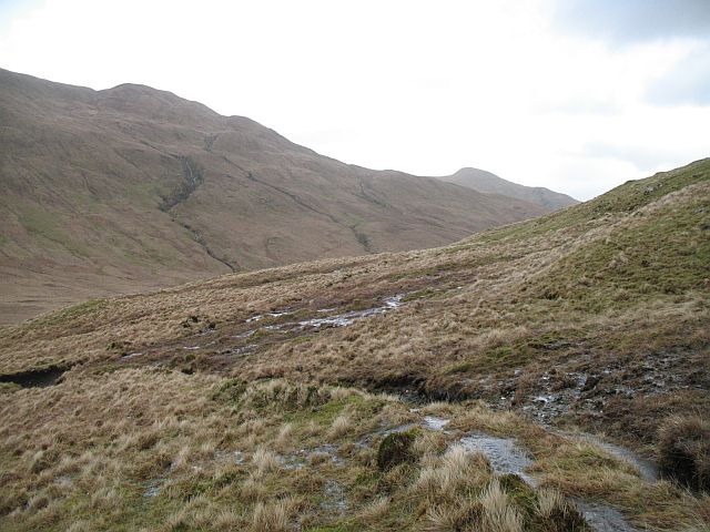
Waterlogged ground
Steep wet land on Beinn Chaorach. Eventually some slopes become heavily waterlogged and slump. Landslides and erosion gullies are common here.
The OS imply restricted access here with range symbols. As the time of publication there was no live firing here, no flags nor notices. The range boundary is along the south ridge of Beinn a' Mhanaich. There is no restriction to responsible access here.
The OS imply restricted access here with range symbols. As the time of publication there was no live firing here, no flags nor notices. The range boundary is along the south ridge of Beinn a' Mhanaich. There is no restriction to responsible access here.
 Map © Crown Copyright")
TIP: Click the map for more Large scale mapping
- Grid Square
- NS2793, 6 images (more nearby 🔍)
- Photographer
- Richard Webb (more nearby)
- Date Taken
- Saturday, 8 March, 2008 (more nearby)
- Submitted
- Sunday, 9 March, 2008
- Subject Location
-
OSGB36:
 NS 279 931 [100m precision]
WGS84: 56:5.9978N 4:46.0611W - Camera Location
-
OSGB36: NS 279 931
- View Direction
- Northwest (about 315 degrees)