2008
TQ5875 : Greenhithe: Johnson's Wharf conveyor (1)
taken 16 years ago, near to Greenhithe, Kent, England
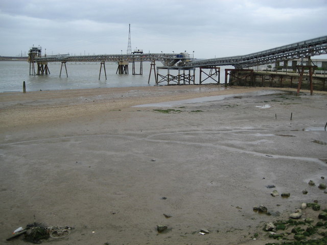
Greenhithe: Johnson's Wharf conveyor (1)
Johnson's Wharf is operated by Lafarge Aggregates and the function of the pier appears to be to convey sand from barges onto the land. See TQ5875 : Greenhithe: Johnson's Wharf conveyor (2) for the end of the conveyor. The tower visible over the top of the conveyor is one of the two very tall pylons used to support high voltage electricity cables crossing over the River Thames. In fact the one in view is on the opposite, Essex, side of the river. A long abandoned bicycle lies in the foreshore mud lower left.
 Map © Crown Copyright")
TIP: Click the map for more Large scale mapping
- Grid Square
- TQ5875, 97 images (more nearby 🔍)
- Photographer
- Nigel Cox (more nearby)
- Date Taken
- Sunday, 2 March, 2008 (more nearby)
- Submitted
- Sunday, 9 March, 2008
- Subject Location
-
OSGB36:
 TQ 581 753 [100m precision]
WGS84: 51:27.2766N 0:16.4458E - Camera Location
-
OSGB36: TQ 581 751
- View Direction
- North-northeast (about 22 degrees)