2008
SD9431 : Graining Water
taken 16 years ago, 4 km NW of Slack, Calderdale, England
This is 1 of 3 images, with title Graining Water in this square
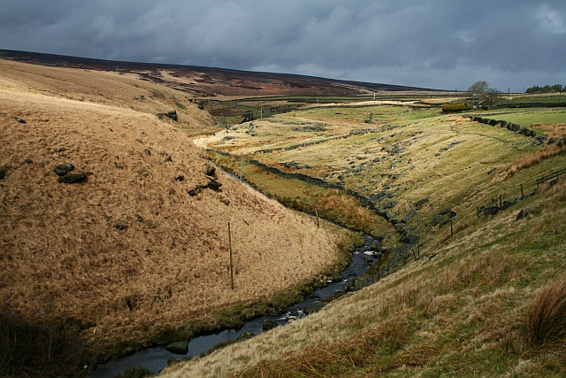
Graining Water
This is the runoff from Widdop reservoir, a mile or so to the NE, and eventually joins the Calder at Hebden Bridge.
 Map © Crown Copyright")
TIP: Click the map for more Large scale mapping
- Grid Square
- SD9431, 74 images (more nearby 🔍)
- Photographer
- Steve Partridge (more nearby)
- Date Taken
- Sunday, 9 March, 2008 (more nearby)
- Submitted
- Thursday, 13 March, 2008
- Subject Location
-
OSGB36:
 SD 948 319 [100m precision]
WGS84: 53:47.0039N 2:4.8239W - Camera Location
-
OSGB36: SD 949 317
- View Direction
- North-northwest (about 337 degrees)