2008
SD9431 : Old Packhorse route from Graining Water
taken 16 years ago, 4 km NW of Slack, Calderdale, England
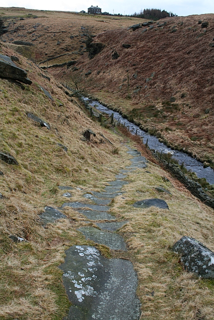
Old Packhorse route from Graining Water
Looking back down the Pennine Way with Gorple Cottages on the skyline.
 Map © Crown Copyright")
TIP: Click the map for more Large scale mapping
- Grid Square
- SD9431, 74 images (more nearby 🔍)
- Photographer
- Steve Partridge (more nearby)
- Date Taken
- Sunday, 9 March, 2008 (more nearby)
- Submitted
- Saturday, 15 March, 2008
- Subject Location
-
OSGB36:
 SD 948 316 [100m precision]
WGS84: 53:46.8421N 2:4.8236W - Camera Location
-
OSGB36: SD 948 316
- View Direction
- South-southwest (about 202 degrees)