2008
NS1950 : Campbelton Farm, Hunterston
taken 16 years ago, near to West Kilbride, North Ayrshire, Scotland
Campbelton Farm, Hunterston
New lambs in this field.
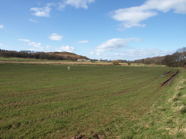
The picture shows the area from which material was removed for the land reclamation to build Hunterston ore/coal terminal and the dry dock. The farm is sitting at the original level of the field. The edges show evidence of the reduced level as well. Topsoil was replaced and the farm access moved to the north once material was removed.
The picture shows the area from which material was removed for the land reclamation to build Hunterston ore/coal terminal and the dry dock. The farm is sitting at the original level of the field. The edges show evidence of the reduced level as well. Topsoil was replaced and the farm access moved to the north once material was removed.
 Map © Crown Copyright")
TIP: Click the map for more Large scale mapping
- Grid Square
- NS1950, 21 images (more nearby 🔍)
- Photographer
- wfmillar (more nearby)
- Date Taken
- Monday, 17 March, 2008 (more nearby)
- Submitted
- Monday, 17 March, 2008
- Subject Location
-
OSGB36:
 NS 197 504 [100m precision]
WGS84: 55:42.8207N 4:52.2705W - Camera Location
-
OSGB36: NS 197 503
- View Direction
- Northwest (about 315 degrees)