2008
SU2980 : The Berkshire Downs between Lambourn and Ashbury
taken 16 years ago, near to Upper Lambourn, West Berkshire, England
This is 1 of 2 images, with title The Berkshire Downs between Lambourn and Ashbury in this square
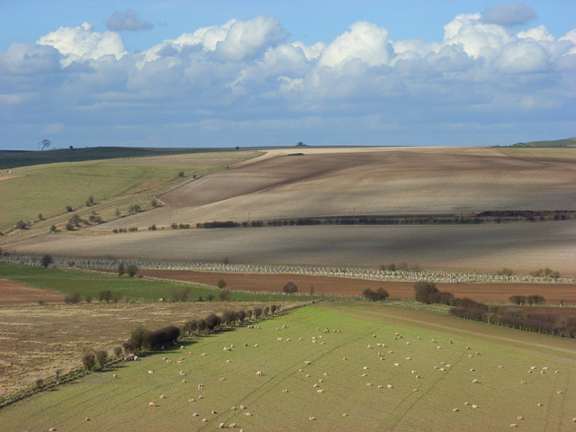
The Berkshire Downs between Lambourn and Ashbury
The view from Near Down of the mixed farmland near Ashdown House. The lower half of the picture is in SU2980. The B4000 passes just above the brownest field. Within the ploughed field on the opposite hillside a small valley is visible. This is at roughly SU291813. Weathercock Hill is on the skyline to the left.
 Map © Crown Copyright")
TIP: Click the map for more Large scale mapping
- Grid Square
- SU2980, 16 images (more nearby 🔍)
- Photographer
- Andrew Smith (more nearby)
- Date Taken
- Sunday, 9 March, 2008 (more nearby)
- Submitted
- Monday, 17 March, 2008
- Subject Location
-
OSGB36:
 SU 292 809 [100m precision]
WGS84: 51:31.5758N 1:34.8294W - Camera Location
-
OSGB36: SU 291 797
- View Direction
- NORTH (about 0 degrees)