1998
NN1367 : Coire Riabhach of Mullach nan Coirean
taken 26 years ago, near to Achriabhach, Highland, Scotland
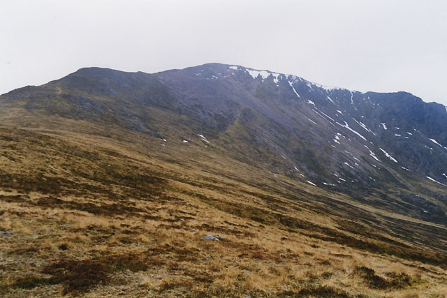
Coire Riabhach of Mullach nan Coirean
The slopes of the coire are rough grass, and with peat hags lower down. However, once you're on the north east ridge of the Mullach, as here, the walking is fine.
 Map © Crown Copyright")
TIP: Click the map for more Large scale mapping
- Grid Square
- NN1367, 8 images (more nearby 🔍)
- Photographer
- Nigel Brown (more nearby)
- Date Taken
- Sunday, 22 March, 1998 (more nearby)
- Submitted
- Wednesday, 19 March, 2008
- Subject Location
-
OSGB36:
 NN 132 676 [100m precision]
WGS84: 56:45.7538N 5:3.3820W - Camera Location
-
OSGB36: NN 135 679
- View Direction
- Southwest (about 225 degrees)