1989
NY7042 : Rotherhope Fell Mine
taken 35 years ago, near to Leadgate, Cumbria, England
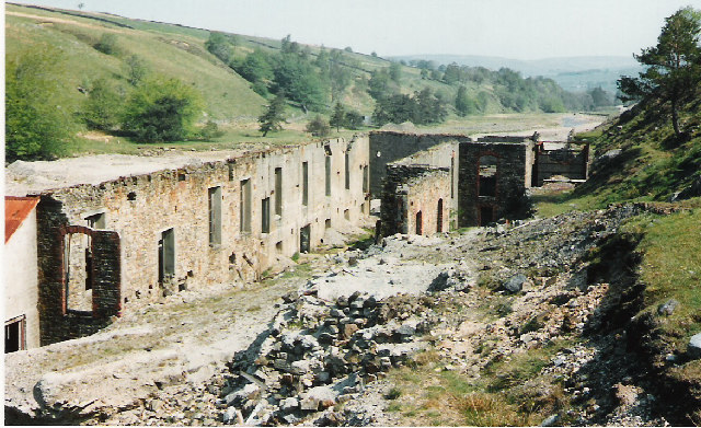
Rotherhope Fell Mine
These are the remains of the mineral processing buildings at the mouth of Blackburn Level, the principal entrance to the mine.
 Map © Crown Copyright")
TIP: Click the map for more Large scale mapping
- Grid Square
- NY7042, 4 images (more nearby 🔍)
- Photographer
- Malcolm Street (more nearby)
- Date Taken
- 1989 (more nearby)
- Submitted
- Monday, 31 October, 2005
- Subject Location
-
OSGB36:
 NY 701 427 [100m precision]
WGS84: 54:46.6988N 2:27.9821W