2008
SS6436 : Haxton Down Lane, Bratton Fleming
taken 16 years ago, near to Bratton Fleming, Devon, England
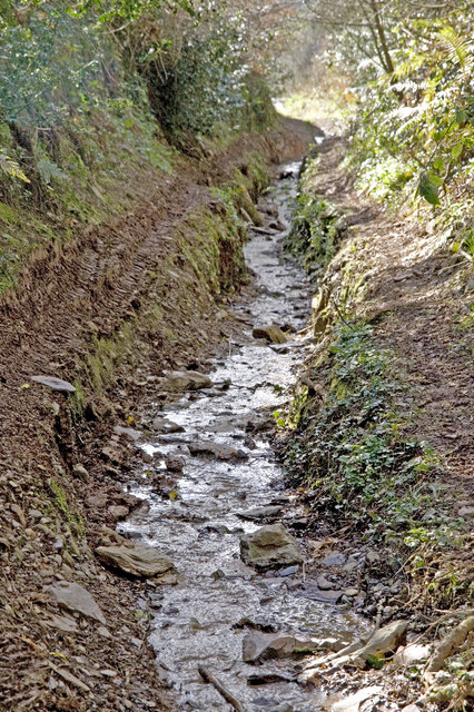
Haxton Down Lane, Bratton Fleming
A stream runs along the lane at this point and storm-water has eroded the subsoil to a depth of 1m. Even so, a quad bike has been driven up straddling the two banks.
 Map © Crown Copyright")
TIP: Click the map for more Large scale mapping
- Grid Square
- SS6436, 5 images (more nearby 🔍)
- Photographer
- Rabbi WP Thinrod (more nearby)
- Date Taken
- Monday, 17 March, 2008 (more nearby)
- Submitted
- Thursday, 20 March, 2008
- Subject Location
-
OSGB36:
 SS 645 368 [100m precision]
WGS84: 51:6.9035N 3:56.2165W - Camera Location
-
OSGB36: SS 646 369
- View Direction
- WEST (about 270 degrees)