2008
SO5213 : An arable field and the Welsh borderlands
taken 16 years ago, near to Dixton, Monmouthshire/Sir Fynwy, Wales
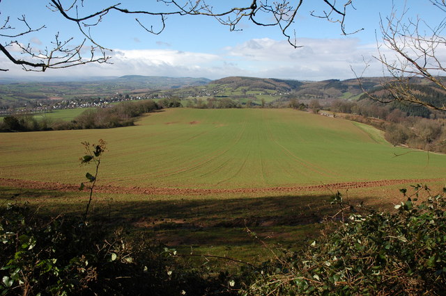
An arable field and the Welsh borderlands
View from the edge of Beaulueu Wood over the borderlands of Monmouthshire and south Herefordshire. Part of Monmouth can be seen in the middle distance on the left.
 Map © Crown Copyright")
TIP: Click the map for more Large scale mapping
- Grid Square
- SO5213, 51 images (more nearby 🔍)
- Photographer
- Philip Halling (more nearby)
- Date Taken
- Friday, 21 March, 2008 (more nearby)
- Submitted
- Monday, 24 March, 2008
- Subject Location
-
OSGB36:
 SO 526 133 [100m precision]
WGS84: 51:49.0219N 2:41.2902W - Camera Location
-
OSGB36: SO 529 130
- View Direction
- Northwest (about 315 degrees)