2008
SK5030 : Boundary fence
taken 16 years ago, near to Thrumpton, Nottinghamshire, England
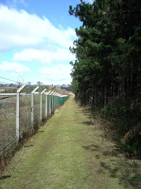
Boundary fence
This is the perimeter fence to Ratcliffe-on Soar Power Station. The 1:50000 map from the early 1970s shows this as a public footpath. Although the track is obviously kept clear of undergrowth for security purposes, giving an easy walk, the public footpath has in fact been diverted through the woodland to the right; spotting the waymarks is an amusing challenge!
 Map © Crown Copyright")
TIP: Click the map for more Large scale mapping
- Grid Square
- SK5030, 55 images (more nearby 🔍)
- Photographer
- Alan Murray-Rust (more nearby)
- Date Taken
- Friday, 21 March, 2008 (more nearby)
- Submitted
- Tuesday, 25 March, 2008
- Subject Location
-
OSGB36:
 SK 509 301 [100m precision]
WGS84: 52:52.0020N 1:14.7023W - Camera Location
-
OSGB36: SK 509 301
- View Direction
- North-northwest (about 337 degrees)