2008
SE9243 : Goodmanham Dale, Kiplingcotes
taken 16 years ago, 4 km ENE of Goodmanham, East Riding of Yorkshire, England
This is 1 of 2 images, with title Goodmanham Dale, Kiplingcotes in this square
Goodmanham Dale, Kiplingcotes
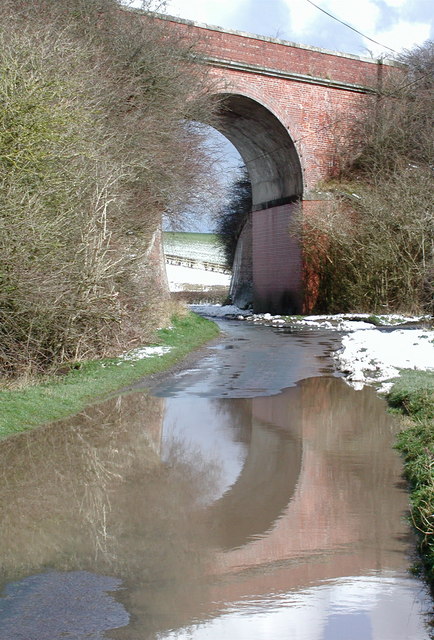
Railway arch where the disused York to Beverley railway line crosses Goodmanham Dale, just west of Kiplingcotes Station.
The railway was proposed by George Hudson "the Railway King" who lived at nearby Londesborough Hall, but although the track between York and Market Weighton opened on 3rd October 1847 the opening of the track from Market Weighton to Beverley was delayed until 1st May 1865. This was due largely to Hudson's downfall after the collapse of the over-inflated railway share price when he was accused of corruption, bribing MPs and selling land he did not own. Hudson left Londesborough in disgrace and was imprisoned in York Castle for debt in 1865. Local landowner and MP, Lord Hotham, also delayed proceedings by opposing the railway but he eventually backed down on the understanding that no trains ran on Sundays and he got his own station here at Kiplingcotes.
The line closed to passengers in November 1965 after Richard Beeching's 1963 report on the viability of the railways, but locals have always argued that this was a mistake and to this day there is an ongoing campaign to have the railway reopened. The ten mile stretch of dismantled track from Market Weighton to Beverley is now the Hudson Way recreational route, a permissive bridleway for walkers and riders which was named in honour of its colourful instigator.
 Map © Crown Copyright")
TIP: Click the map for more Large scale mapping
- Grid Square
- SE9243, 76 images (more nearby 🔍)
- Photographer
- Paul Glazzard (more nearby)
- Date Taken
- Sunday, 23 March, 2008 (more nearby)
- Submitted
- Thursday, 27 March, 2008
- Subject Location
-
OSGB36:
 SE 926 439 [100m precision]
WGS84: 53:53.0192N 0:35.5094W - Camera Location
-
OSGB36: SE 926 439
- View Direction
- East-northeast (about 67 degrees)