2004
SE0178 : Coverdale at Coverhead
taken 20 years ago, near to Woodale, North Yorkshire, England
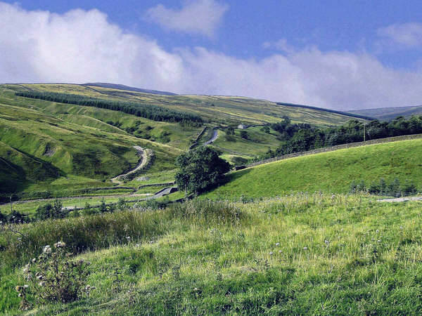
Coverdale at Coverhead
A view of the road leading out of Coverdale towards the steep descent of Park Rash into Kettlewell
 Map © Crown Copyright")
TIP: Click the map for more Large scale mapping
- Grid Square
- SE0178, 21 images (more nearby 🔍)
- Photographer
- Anthony Harrison (more nearby)
- Date Taken
- August 2004 (more nearby)
- Submitted
- Sunday, 6 April, 2008
- Subject Location
-
OSGB36:
 SE 010 783 [100m precision]
WGS84: 54:12.0487N 1:59.1517W - Camera Location
-
OSGB36: SE 014 789
- View Direction
- Southwest (about 225 degrees)