2008
SO0218 : Upper Neuadd Reservoir
taken 16 years ago, 4 km NE of Nant-Ddu, Powys, Wales
This is 1 of 4 images, with title Upper Neuadd Reservoir in this square
Upper Neuadd Reservoir
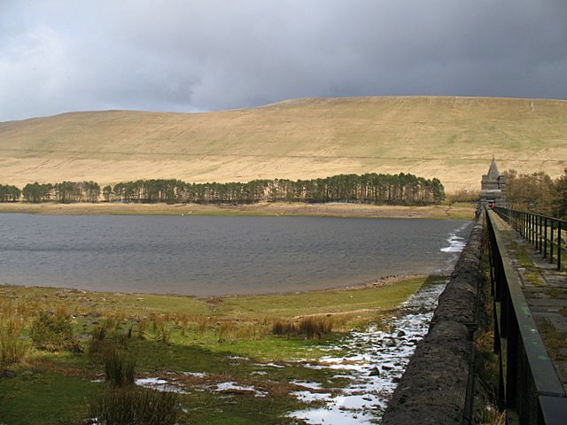
Upper Neuadd Reservoir was built between 1896 and 1902 in part from limestone quarried near Dowlais brought in using a temporary railway line constructed from Torpantau halt on the Brecon & Merthyr Junction railway. This route is now a bridleway followed by the Taff Trail. Other stone was sourced from quarries between Pant and Pontsticill down the valley. With a water level of 1506ft, this reservoir is the highest in Fforest Fawr Geopark and indeed in Brecon Beacons National Park.
The Upper Reservoir has a capacity of 340 million gallons and the dam, seen here on the right, is 75ft high.
The ridge in the background is Tor Glas reaching over 600m in height. A snow storm was on its way, indicated by the ominous black clouds.
The Upper Reservoir has a capacity of 340 million gallons and the dam, seen here on the right, is 75ft high.
The ridge in the background is Tor Glas reaching over 600m in height. A snow storm was on its way, indicated by the ominous black clouds.
 Map © Crown Copyright")
TIP: Click the map for more Large scale mapping
- Grid Square
- SO0218, 25 images (more nearby 🔍)
- Photographer
- Sharon Loxton (more nearby)
- Date Taken
- Sunday, 6 April, 2008 (more nearby)
- Submitted
- Monday, 7 April, 2008
- Subject Location
-
OSGB36:
 SO 029 187 [100m precision]
WGS84: 51:51.5483N 3:24.6309W - Camera Location
-
OSGB36: SO 027 187
- View Direction
- East-northeast (about 67 degrees)