2008
SZ0991 : Bournemouth: by-pass subway on footpath C12
taken 16 years ago, near to Bournemouth, Bournemouth, Christchurch & Poole, England
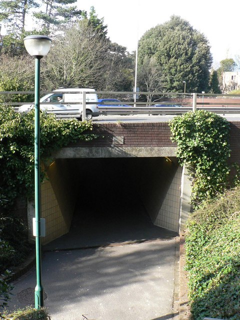
Bournemouth: by-pass subway on footpath C12
This pedestrian subway carries footpath C12 under the town-centre by-pass between Dean Park Road (far end) and Madeira Road (behind camera). The stone above the arch bears the date 1981 with a C top left and a D bottom right. This supposedly stands for Charles and Diana, who married in that year (see SZ0991 : Bournemouth: by-pass subway detail, the identical stone on the opposite side).
Public rights of way in Bournemouth
A series of pictures documenting the public rights of way in the borough of Bournemouth. The pictures of the rights of way all have links to the next picture on the same route, in each direction.
The rights of way are all documented, in numerical order, in this article:
Link
 Map © Crown Copyright")
TIP: Click the map for more Large scale mapping
- Grid Square
- SZ0991, 855 images (more nearby 🔍)
- Photographer
- Chris Downer (more nearby)
- Date Taken
- Tuesday, 8 April, 2008 (more nearby)
- Submitted
- Wednesday, 9 April, 2008
- Subject Location
-
OSGB36:
 SZ 091 916 [100m precision]
WGS84: 50:43.4372N 1:52.3128W - Camera Location
-
OSGB36: SZ 091 915
- View Direction
- NORTH (about 0 degrees)