1971
NG8661 : The Great Gash of Beinn Alligin
taken 53 years ago, 4 km NNE of Rechullin, Highland, Scotland
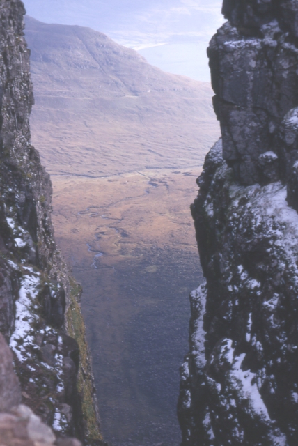
The Great Gash of Beinn Alligin
Looking down through the Great Gash to the end of the ridge of Liathach and Loch Torridon beyond.
 Map © Crown Copyright")
TIP: Click the map for more Large scale mapping
- Grid Square
- NG8661, 46 images (more nearby 🔍)
- Photographer
- Anne Burgess (more nearby)
- Date Taken
- October 1971 (more nearby)
- Submitted
- Saturday, 7 May, 2005
- Subject Location
-
OSGB36:
 NG 865 611 [100m precision]
WGS84: 57:35.3907N 5:34.3851W - Camera Location
-
OSGB36: NG 865 612
- View Direction
- South-southeast (about 157 degrees)